Flying High Tech in the Vineyards
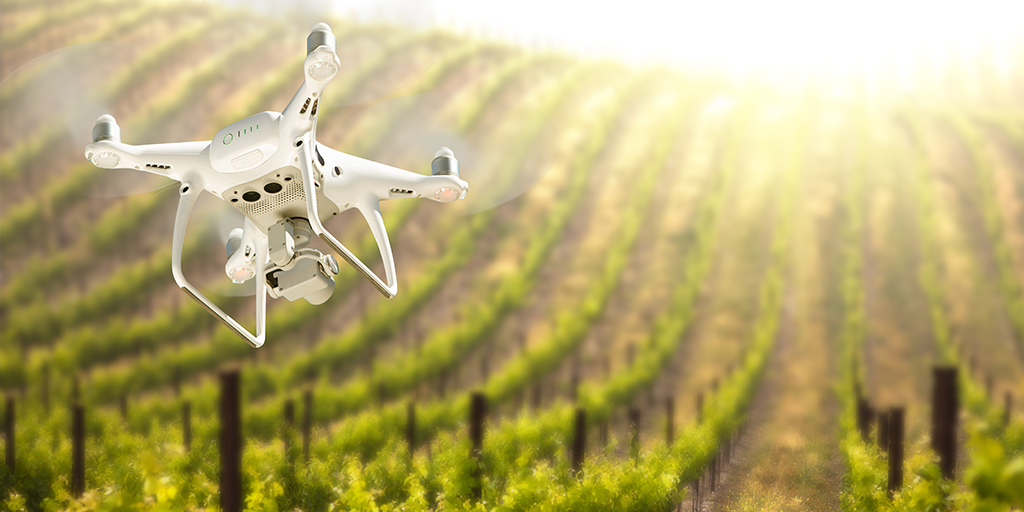
As a kid, I was always fascinated by World War planes and glued many models together. What kid is not attracted by any kind of flying machines? Recently I was talking to a vineyard manager of one our partner wineries about a different kind of flying machines: drones.
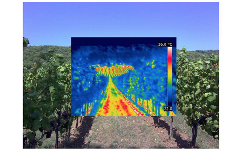
This type of precision analysis was initially used by Midwest farmers to manage corn, soybeans, sugar beets and other traditional crops. Remote sensing involves the acquisition of spectral data from several platforms, such as satellites, aircrafts, and remotely piloted aerial systems (RPAS). Imagery, computers and aerial technology are now taking a growing part in modern viticulture and vine growing. Plants absorb and reflect wavelengths of light. Color infrared imagery (CIR) helps to detect issues with plants before anything is even visible to the human eye. The Normalized Differential Vegetation Index (NDVI) is an imagery analysis tool used to measure plant vigor and biomass. This technology helps us strengthen crops, take action on diseases or determine watering and fertilization regimes.
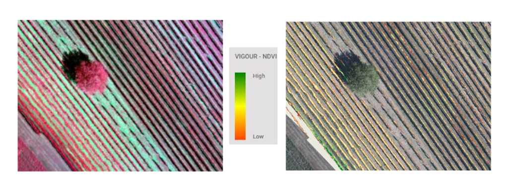
Within the last fifteen years, those techniques have been implemented in many vineyards. Since 2002, large wineries in California, Oregon and Washington State have tested this technology to determine the health of their “leafy plant material” or vines. As a result, winemakers could tell that vigorous areas on their maps produced fruits with shade, large berries with lower Brix (sugar content) and delayed ripening. However, less vigor indicated stressed areas with smaller berries, more flavors, higher Brix and early ripening. Picking decisions started to be made from a few feet in the air by combining zones within each vineyard that had the same NDVI. Washington State University collaborated on this project to create one the first Geographical Information System databases (GIS).
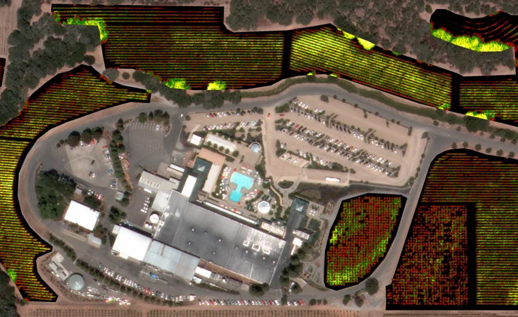
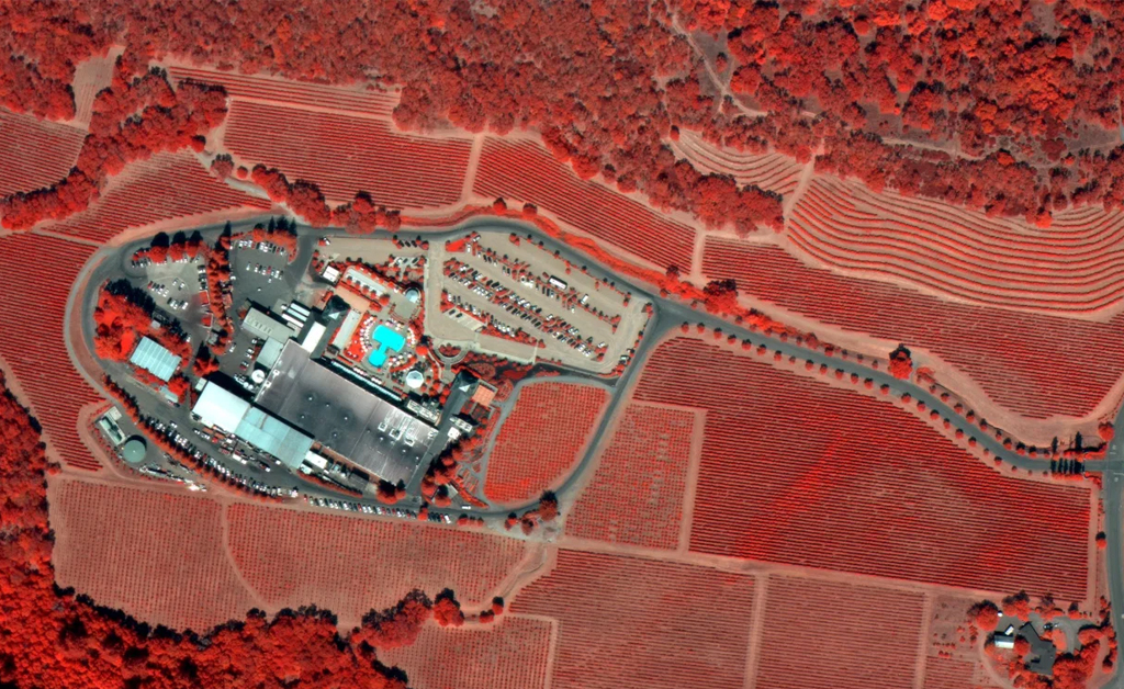
The images below show Coppola Winery in Sonoma and its surrounding vineyards.
Drones are now also used to determine new suitable land to plant. The amount of daily sunlight, the right soils, the orientation of vine rows and adequate air flow are important parameters to considered. Federal agencies are now making this data free and available.
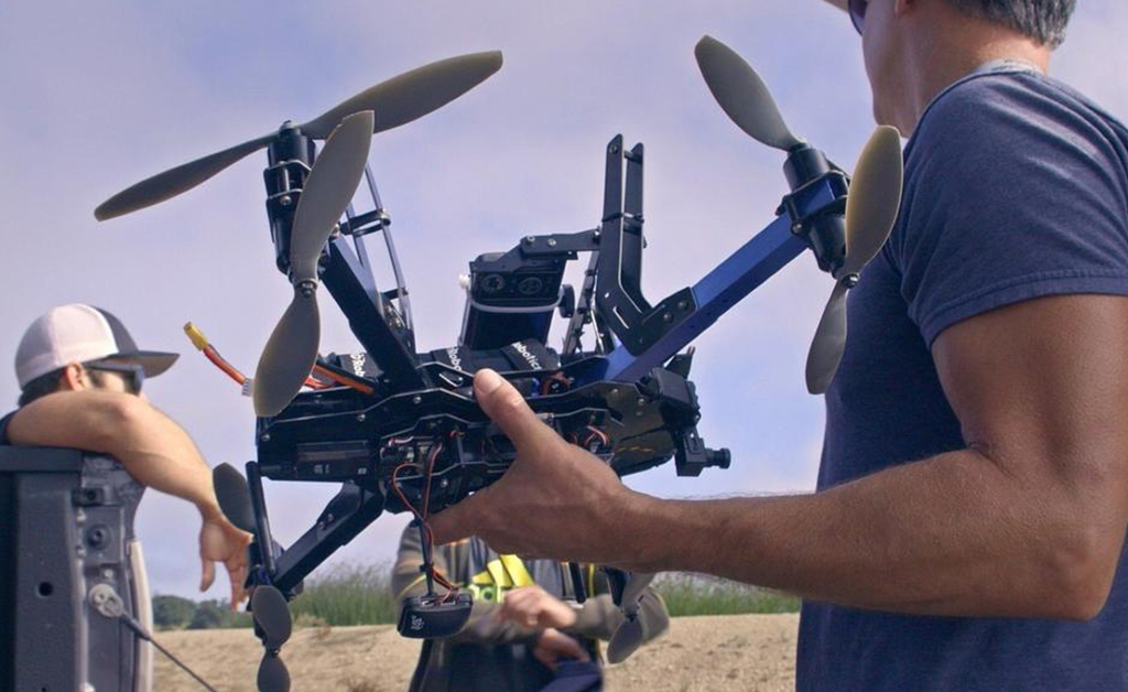
In the past, farmers had to walk the rows in order to see what was wrong. Now, when they go into the vineyard, they already know what’s wrong. Programs like GreenSeeker are being used in California to collect extremely accurate NDVI readings. GreenSeeker optically scans the vineyard canopy from just a few feet above the row and calculates NDVI conditions instantaneously. The costs associated with vineyard establishment can take years to recover. Using GIS technology to help reduce risk and make better vineyard management decisions can increase the bottom line. Each drone is outfitted with a near-infrared camera, and it collects between four and nine gigabytes of data for every 250 acres it covers.
Specialists believe that using drones provides a huge opportunity for protecting honey bees, saving water and improving crop yields around the world. They estimate that 80 percent of the world’s drones were put to work in the agriculture industry in 2020. A company is even developing a new ground drone that will detect vine-attacking diseases and spray pesticides directly on the affected areas. This targeted approach will help farmers around the world avoid widespread crop-dusting, which would reduce the use of pesticides that are harmful for humans and bees.
The highest spatial resolution available through planes and satellites is around 20 inches /pixel, which is too coarse to monitor the vines’ leaves, shoots and the soil where they grow. Sensors onboard manned airborne vehicles like drones offer a much higher resolution at a fraction of the cost.
This technology and its applications in the vineyards will improve crop productivity and sustainability. Farmers will notice issues before they become unmanageable and focus their energies on areas where there are issues.
The wine industry is flying high.